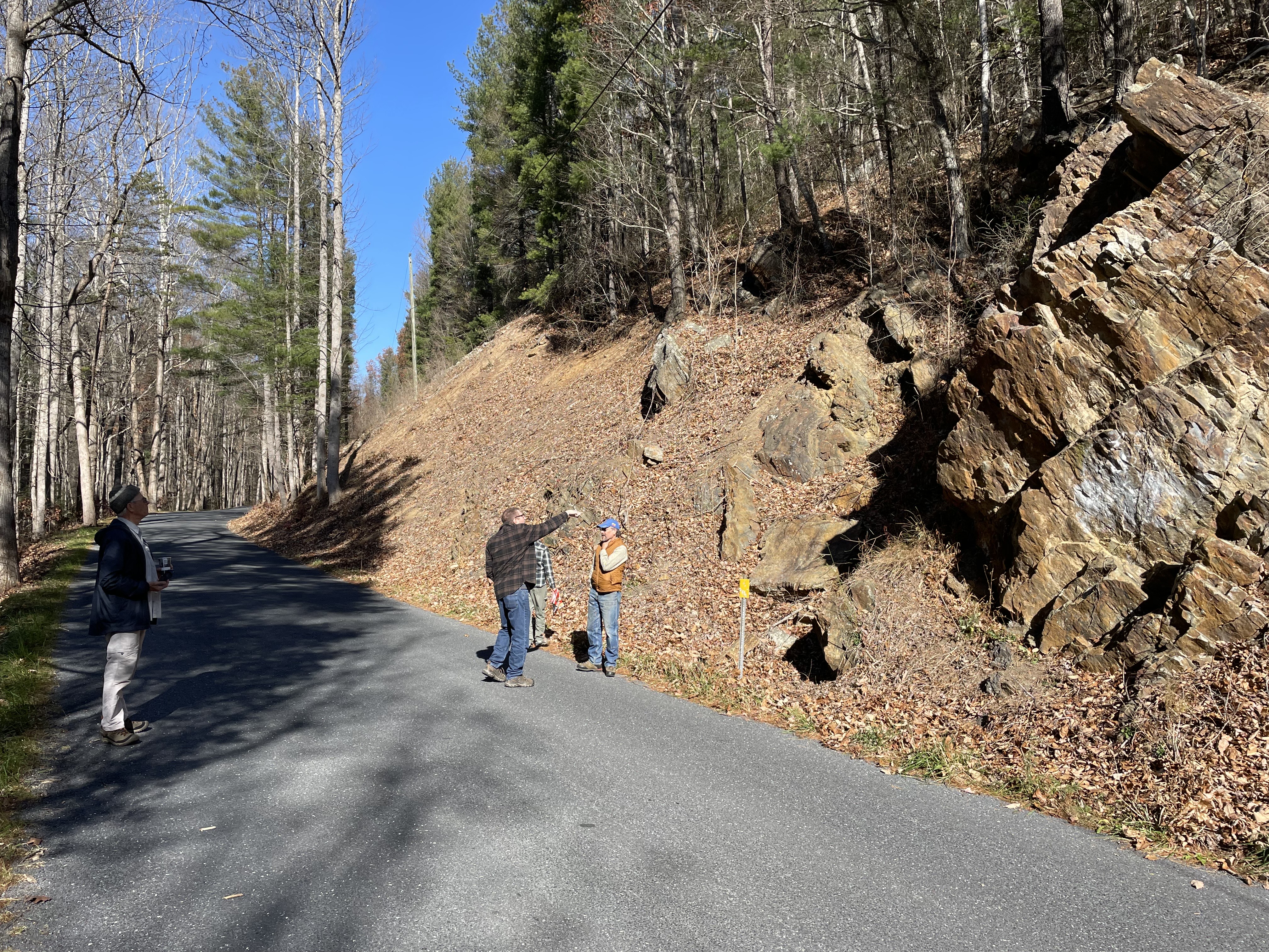
The group looking at various beds of sandstone with a few thin coal seams in the Price formation. Photo by Malcolm.
On Thursday, November 13, a beautiful fall day, two other HMN members and three friends joined me in Stokesville for a tour of notable rock outcrops in the Stokesville, North River Gorge, and Staunton Dam areas. The tour focused on the two most common rock formations in the North River Ranger District of the George Washington National Forest, as well as the four mountain-building events that created the high source lands to the east and the extensive erosion that shaped the Blue Ridge, Shenandoah Valley, and Allegheny regions over millions of years.
Our first stop was at North River Gap in Stokesville, where we observed a large outcrop of the Price (Pocono) formation. This early Mississippian-aged (about 380 million years ago) sequence of sandstones, conglomerates, and dark shales is the youngest formation in the Shenandoah Mountain area. It was deposited after the Acadian Orogeny, filling a basin created by the collision of Baltica and Avalon plates. This formation originated from a broad alluvial plain and delta, with river channels indicated by quartz pebble conglomerates, and features fossil impressions of tree branches and bark. The history of Stokesville as a boom town around 1900 was linked to attempts to mine coal and later logging, which ultimately led to its decline within about a decade.
Our second stop was just a third of a mile away at the Wild Oak Trail parking lot, where we discussed the region’s geologic history using display boards, maps, and typical rocks from Shenandoah Mountain’s three main formations. We then hiked a two-mile round trip into North River Gorge, walking along the old logging railroad grade, where I pointed out where the builders had to blast through hard sandstone. Along the trail, we observed a prominent exposure of soft shales and thin-bedded sandstone, likely formed in wetlands near a floodplain. Near the overlook, we enjoyed a broad view of North River Gorge while having lunch.
The third stop, about five miles upriver near North River Campground, featured an outcrop of the older Late Devonian Hampshire Formation, characterized by reddish-brown sandstones, shales, and mudrock. This formation developed in a broad inland sea far from the ancient North American west coast, with features indicating small stream flows that periodically reversed, similar to landscapes we see today.
Although we were running late, everyone chose to make one more stop near Staunton Dam, where we explored the tunnel built through Lookout Mountain in the 1920s to supply water to Staunton during a crisis. This federally protected land was selected for its clean, reliable water source, ensuring safe drinking water for generations.
The outing provided five hours of continuing education credits for HMN members, and all participants—trail workers, a retired USFS silviculturist, and fellow naturalists—enjoyed the day, making new friends and learning about our local geology. It was a wonderful example of what Master Naturalists are all about.
Malcolm Cameron, HMN Cohort 3
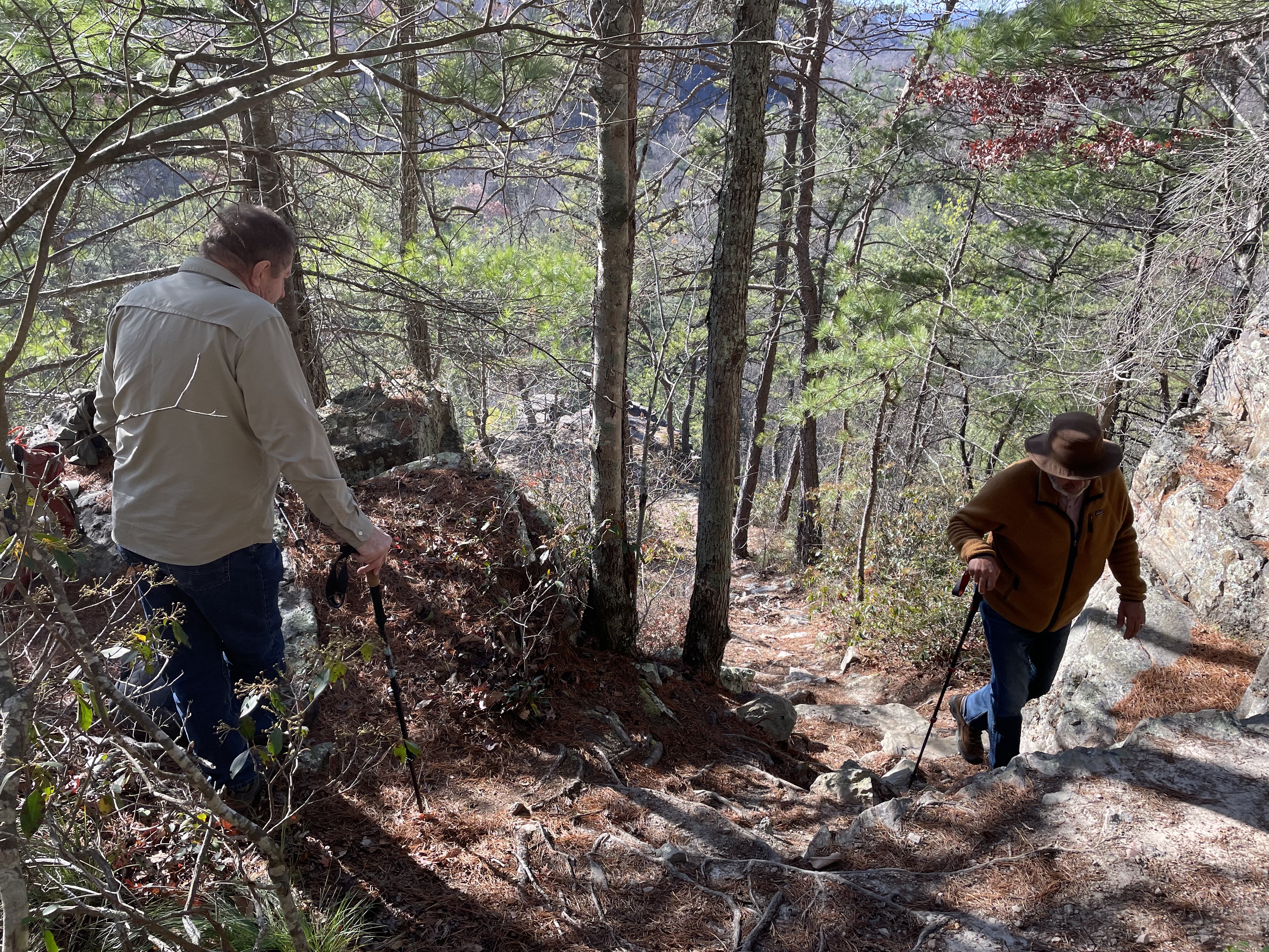
Just above the overlook of North River Gorge, Gary Flynn and Bill Howe walking up from the sandstone outcrop. Photo by Malcolm.
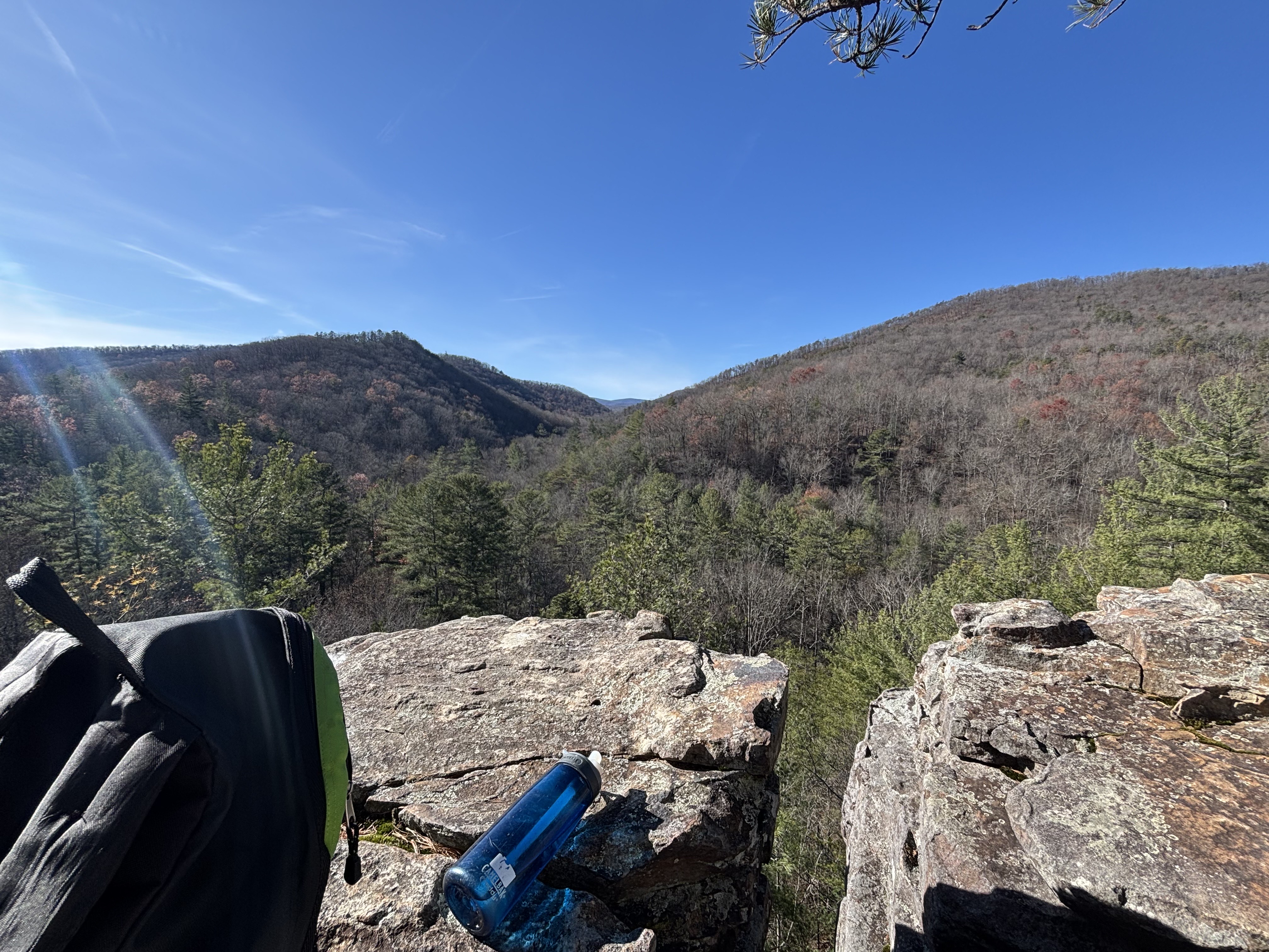
From the Lookout Mountain Trail overlook, we enjoyed lunch with views of sandstone and quartzite cliffs along North River Gorge. In the distance are Trimble Mountain (right) and Elkhorn Mountain (left). Photo by Larry Ragland.


